2.2 Theoretical - Improving Plot, Explaining
#evaluatingplots
Q2 Give 3 suggestions for improvement of the following plot, and explain your rationale based on visualization principles. If it’s too small, you can zoom in on to the pdf.
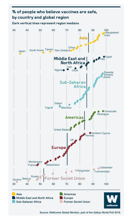
- Rearranging regions. Split countries in Former Soviet Union to Europe and Asia. Otherwise, people would think that it is a continent just like other areas. Also, why Africa is split? New Zealand is not in Asia.
- The height of each area should be the same. It is confusing why sub-Saharan Africa and Europe are taller than other countries.
- Country names are in different positions, making it hard to confirm which point is the country. This should be uniformed. If possible, an interactive chart which allow country names to appear when users stop their mouse cursor there would be chearer.